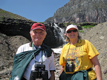
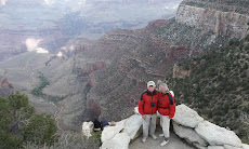
Above as we left Grand Teton National Park.

This illustrates the splendid view we had of the Snake River as we snaked along 22/26. We were surprised as to how long and big the river actually is.
Arco is the first city to be light using nuclear power in 1951.

Arco is situated near the Craters of the Moon park and the Experimental Breader Reactor which provided the power. It is now a museum which we toured. The area is also home to the Idaho National Laboratory which conducts research and training in nuclear energy. We stayed at the Mountain View RV Park in Arco which featured free pancake breakfasts to its guests.

We stayed four nights in Arco, visiting Craters of the Moon National Monument and Preserve which contains three young lava fields covering almost half a million acres.


The lava fields had lots of caves accessible from the surface. We toured one while we were on a ranger guided walk through the lava fields. We were on a paved walkway and could not leave it. It would have been almost impossible to walk through the field otherwise. Those lava rocks are extremely rough and sharp and very uneven.
 Oops! Looks like my feet are off the trail. My hat blew off and I had to go a few feet off the trail to retrieve it lodged within a shallow crevice.
It's amazing seeing flowers growing amidst these barren lava rocks.

We also visited the Experimental Breeder Reactor museum which also was not far from Arco. It is not only the site of the first production of useable electric power from a nuclear reactor but also where nuclear reactors were being developed to power airplanes for long range flight. This was abandoned when aerial refueling was perfected.


And below, believe it or not, is the reactor being developed for airplanes. I suspect that there was a lot of effort to make this smaller and lighter.

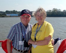
On Aug 24 we traveled 207 miles to Boise and stayed there for a week. We got our overheating problem fixed at a local Freightliner dealer in Nampa. The problem was due to the radiator being clogged with dirt and was only visible from the inside. While in Boise, we toured the nearby World Center for Birds of Prey, rode the Horseshoe Express tourist railroad, visited the Idaho State Prison museum and enjoyed the downtown parks and restaurants.
At the Birds of Prey center we saw several demonstrations on falconing and various birds on display by the handler. Below is the Gyrfalcon or artic falcon, the largest falcon in the world. It did not seem so big viewing it.

Here we are by a large cage housing two large California condors.

We spent a day in Horseshoe Bend, ID for the tourist train. Below is a picture of the combined liquor store, laundromat and RV park by the train station. That place apparently had everything, but we stayed in Boise.

Horseshoe Bend had lots of history as noted below.

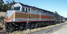
The Thudermountainline RR name's more impressive than the tourist route we followed which was primarily along a river, but nonetheless it was very enjoyable.


Above is the diesel that pulled the train. Was hoping for steam, but this did OK.
 The bar in our car made the trip even more enjoyable.
Along with the ride, we enjoyed a 'hobo' lunch complete with stick and bandana, and a very pleasant view, such as below.


Here is one of the cars, it actually came from the Long Island RR and was refurbished.

Lillian can't believe this car came from Long Island, we may have ridden in it as kids.
We left Boise on Aug 29 for Mountain Home, 19 miles away, to visit the Bruneau State Park which has the tallest sand dune in North America, 470 feet tall.
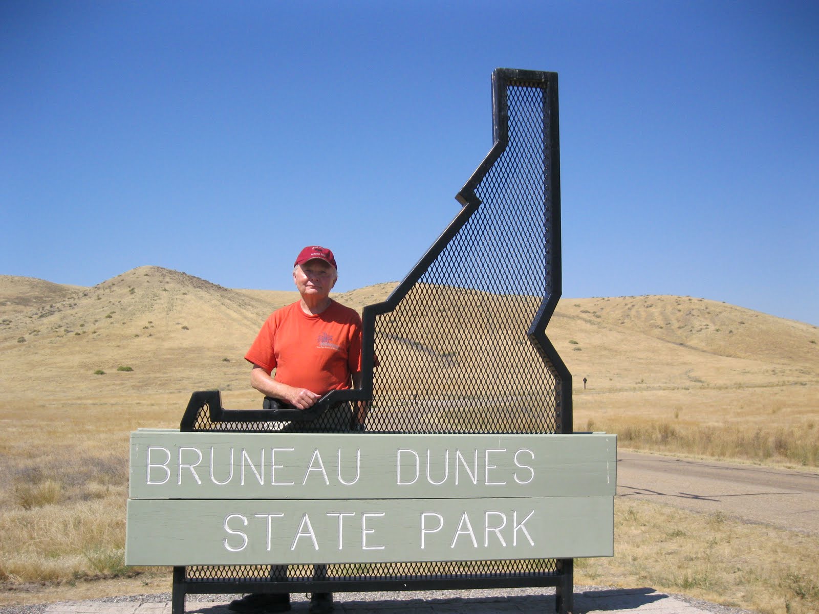


Above are two different dunes, I don't know which is the tallest, but I at least got a picture of it. Take your pick. Later on, we had a nice dinner at Carmela Vineyards along with some really nice wine, but not as good as we got in upstate New York.
On the first of September we left Mountain Home and drove 53 miles to Declo, ID to see the place where Evil Kneivel jumped the Snake River. Yes, from Grand Teton till now, we are by the Snake River!
The Snake River is the largest tributary of the Columbia. The river begins in Northwestern Wyoming south of Yellowstone Park and west of the Continental Divide at an elevation of just over 9,800 feet. From there, where several small streams converge to form the river, the Snake flows south for more than 100 miles before turning west into Idaho and flowing across the southern part of the state, and then north to its confluence with the Clearwater at Clarkston, Washington, and Lewiston, Idaho. From there the river flows west through southern Washington to its confluence with the Columbia a few miles south of Pasco. At the confluence, the elevation of the river is 340 feet above sea level. Thus in its 1,056 miles the Snake drops more than 9,400 feet, a step decline.
There are a number of waterfalls across southern Idaho. Early French fur traders called the Snake a “mad river,” apparently for good reason. The annual discharge of the Snake into the Columbia is 27.5 million acre feet, or about 14.5 percent of the annual discharge of the Columbia into the ocean. The Snake drainage basin encompasses 92,960 square miles, or about 36 percent of the entire Columbia River Basin. Obviously, while vast, the Snake River Basin is quite arid.
The rapid descent and rocky canyon of the Snake made it a good river for hydropower development; the first hydropower dam was built in 1900 at Swan Falls and supplied electricity to the Trade Dollar Mine at Silver City 28 miles away. The Snake also is heavily tapped for irrigation. Above Milner Dam, near Burley, Idaho, virtually the entire flow of the river is pumped or diverted. Downstream of Milner Dam, the Snake is replenished by springs and tributaries, essentially amounting to a reborn, or second river.
The Snake has been called the lifeline of southern Idaho and the multi-billion-dollar agricultural industry in that part of the state. Hydropower dams and irrigation facilities were developed simultaneously along the Snake, as pumping facilities were powered by electricity and communities developed around the farm settlements.
The last major dam was completed in 1975 — Lower Granite, a federal dam in Washington. In all, there are 22 hydropower dams on the mainstem Snake River — 15 in Idaho, three on the Idaho/Oregon border, and four in Washington. The Snake produces more than 1,100 megawatts of electricity — enough for the city of Seattle — and the water withdrawals irrigate 3.8 million acres.
Before the construction of dams, the Snake produced huge volumes of salmon and steelhead, and the fish spawned in the mainstem and in tributaries as far inland as Shoshone Falls about 600 miles from the confluence with the Columbia. Salmon passage today ends at Hells Canyon Dam, at river mile 247. In its upper reaches, the river remains a popular destination for sport fishing and water recreation; Hells Canyon, the deepest river gorge in North America, is a national recreation area.
The river was named after Indians who lived along its shoreline in present-day southeastern Idaho. Early European fur traders noted that the Indians marked their territory with sticks that showed an image of a snake. The Indians also greeted people by making a snake-like hand motion.
Evel Knievel's jump took place just outside Twin Falls, Idaho which is just to the left in the map below. The site is on private property that is within walking distance from the town along a scenic pathway alongside the river.

The site is just behind the house on the upper right of the picture. The only thing left is the dirt ramp just visible behind the house. He made his jump on Sep 8, 1974. I saw it on live TV at the Capital Center with Wally. Paid a lot of money to see a failed attempt. Evel deployed his parachute and aborted his jump. He landed safely in the river and would live to go on to do other dumb stunts, although I would no longer pay to see them.
While in Declo, we also visited City of Rocks State Park. On his way to California in 1849, emigrant James F. Wilkens described the dramatic geological area he encountered as "City of Rocks." The name remains, as well as hundreds of pioneer inscriptions, wagon ruts, and journal accounts, testifying to the nearly quarter-million people who traveled through here between 1843 and 1869. Visitors today will see nearly the same scene - granite spires and monoliths reaching 60 stories tall.


This is a replica of the wagons used by Mormon settlers headed for Salt Lake City in the mid 19th century. In fact, US 80 from Utah to Omaha generally follows the old wagon trails used by the settlers and gold prospectors of that era. It is a very interesting and historic highway.


As we were leaving the park to return to our RV site in Declo, our way was suddenly blocked by a cattle roundup. It was interesting to watch the cowboys use both trucks and horses as well as horse trailers to drive the cattle. In fact, later on we saw other cattle drives, but they generally stayed on the side or off the road. We continued on this dirt road for about 30 miles and going about 20mph, it seemed like an eternity to get back to Declo.
On Sep 3d, we left Declo, headed home via interstate 80. We headed south out of Idaho on US 84 towards Ogden where we would pick up US 80. As we drove along US84 in Utah, we noticed a sign for Promontory and the Golden Spike National Historic Site. Well, I couldn't pass up the chance to visit this historic site, so there we went. It was further from the highway than I first thought, but certainly well worth the effort.

Promontory Point is ahead in the distance, beyond the mountain range. It lies on the north side of the Great Salt Lake.

It was here on May 10, 1869 that the Golden Spike was laid, completing the nation's first intercontinental RR, connecting California with the East, the Central Pacific RR with the Union Pacific RR, crossing 1,776 (actually Sacramento to Omaha) miles of desert, rivers, and mountains to unite West and East.

 Jupiter meets UNP's 119.
 Above is the Central Pacific's Jupiter, a working replica of the original.

Above are two views of Union Pacific locomotive 119, a replica of the original 1869 locomotive. Below is a painting of the actual event.

The two replica locomotives were steamed up and ran for a short run to demonstrate for the visitors that moment in history. The sounds, smell, smoke, whistles and steam made for a very exciting reenactment and was very much enjoyed by the young and old kids in the crowd.
From here, continued on to Ogden where we stayed overnight. We got there just in time to see a model RR setup and car exhibit in the Union Pacific Station downtown.


The model RR had a replica of the downtown RR yard and station as well as of the track that crossed the Great Salt Lake to shorten the route to Sacramento.
 The car display inside the station was quite interesting, but it was closing time so I had only time to take a quick picture. There was also an extensive Remington fire arms exhibit, but that was now closed. None of these interested us enough to stay in Ogden another night.
 This is downtown Ogden, in front of the station, where there were a number of horse sculptures, something on the order of the painted cows in Beaufort and other cities. We were walking around looking for a nice place for dinner, but found none, so returned back to the motor home for a home cooked meal.
We left Ogden on the 3d of Sep for the 2,500 mile trip back home, with stops in Cheyenne, WY, North Platte & Grand Island,NE, Forrest City, IA to get our mechanized awning fixed, East St. Louis, IL, and Chattanooga, TN. We followed US 80 to Iowa.
Along US 80 there were exhibits honoring the settlers who traveled this route in wagon trains. About three trails parallel US 80 that took travelers to Utah and the California gold fields.
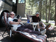
 The wagon wheels serve to indicate the trail. Poor Millie got a sticker in her paw and had to be cuddled and carried back out.
The plaque above briefly tells the story of these wagon trails and the hardships endured.
Cheyenne was cold and rainy, so we stayed only one night and had some buffalo brat wursts at Perry's Bison Ranch RV park. Next day we headed to North Platte, NE and stayed two nights at the Holiday RV Park. This worked out well because they gave us a discount coupon for any Holiday RV park, which we were able to use in Chattanooga. In North Platte we visited the Buffalo Bill Cody's 1896 ranch.

 Buffalo Bill gave us a big greeting.

Also in North Platte is the Union Pacific's Bailey Yard, the world's largest train yard where on can see trains as far as the eye can see. Located right next to the yard is the Golden Spike Tower and Visitor Center. From the tower one gets a panoramic view of the whole facility, including repair shops, sand tower, hump yard, etc. I surprised to learn that the wheels on a rail car are not connected. The car simply rests on top of the axle and its weight holds it all together.


From North Platte we continued our journey home, stopping in Forrest City, IA to get the slide out awning mechanism fixed. From there we went to East St. Louis to stay over night at the Casino Queen RV park. When we got there in the evening during heavy rain we found it was closed for the season. Only September and it was closed for the season already! The casino security guards said we could dry camp in the parking area just outside the RV park at no charge. We had a nice dinner in the Casino and left the next morning for Chattanooga and then on to Sun City, arriving safely home on Sep. 11th.
All in all, a very nice two and a half month trip covering a little over 5,700 miles.


.jpg)