Wednesday, August 19, 2009

Headwaters of the Missouri - On the Trail of Lewis & Clark

We traveled 289 miles south east through Montana to Three Forks. Along the way we saw some of the most beautiful parts of Montana; we continuously speculated on how beautiful this would be in the Winter with snow on the ground and mountains. We did not, however, have any intention of actually realizing this experience in the flesh. While at Three Forks, we visited the Headwaters State Park that contained the confluence of the Jefferson, Madison and Gallatin Rivers, so named by Lewis and Clark. The park also contained their encampment site. Captain Clark was the first to visit this area on July 25, 1805; Captain Lewis and his crew followed two days later. It was Clark and his group of 12 who returned here on their way back east on July 13, 1806. The only remnants of their visits, as far as I could determine, were the names of the three rivers. And the only way to view the three rivers coming together to make the Missouri ( USGS says that it is the Madison and Jefferson which join to make the Missouri; locals say it is the three and only the three) is from the air if your local; otherwise, for USGS people, you can see it from ground level. Either way, the area is beautiful and peaceful, rivers, flood plain, and mountains for a backdrop.

Below, I'm standing in front of Lewis and Clark camp site, by the Madison river just above where the Jefferson River comes in. The sign shows the aerial view for those who are USGS believers.


To complete the picture, below right is the Gallatin River just before it goes either into the Missouri or the Madison-Jefferson rivers, while left is the Jefferson and Madison.


Millie is shown below tracking Clark's trail, using scents well over 200 years old. Yes, she is that good.


Another very interesting place we visited was the Madison Buffalo Jump State Park which was down a 7 mile gravel road about 25 miles from the headwaters. Millie had problems getting the scent of Bison, I think the Buffalo signage confused her. But, from that hill top, native Americans stampeded and funneled Bison over the cliff to their death; those that survived were killed the old fashion way. Bison were tremendously useful to native Americans, being used for clothing, tools, and food.


While we were here, we decided to visit Virginia City which was "only" 90 miles away. Man! That was a long 90 miles. What used to be a gold/silver mining "town" is now a dilapidated tourist trap. We had in mind to walk around the town and have dinner there. What a joke. In five minutes, we had time to see it twice. For food, the best they offered was ice cream. We tried it, it was delicious. Lill like the huckleberry. In fact, throughout Montana, at least in Glacier and in Virginia City, huckleberry is quite popular. Below are some of the interesting spots in Virginia City. I must confess, the museum was quite interesting and took more than 5 minutes to see - and it was FREE.


We found a nice restaurant on our way back to Three Forks, including a fixer-upper house, that with a little effort could amount to still not much. But, this is an example of the type of house 19th century pioneers made.


We left Three Forks on Aug 14th and headed for Terry Bison Ranch RV Resort in Cheyenne, Wyoming, 705 miles away.

Glacier National Park-Aug 09

On Aug 4th we arrived in Hungry Horse, MT at the western entrance to Glacier National Park, having traveled a total of 2,680 miles. We drove Going-to-the-Sun road twice in total; it is a 50 mile scenic drive through the park connecting East and West sides of the park. US 2 also connects east and west, but it skirts the park. Along this road, which connects Maine with Washington state, is Marias Pass, on the Continental Divide, 5220 ft high, just 20 miles from Lewis' July 22-25, 1806 campsite. The Corps of Discovery's history would have been significantly changed had Lewis discovered this pass through the Rockies. Before this road was built, the only way for cars to travel this route near Glacier is by loading them on railroad cars. The rail link was started in 1890 after John Stevens, principal engineer of the Great Northern Railway, discovered the pass. It is now part of the BNSF. Marias Pass has a monument to Stevens as seen below.


Below is a picture of our motorhome as we arrived at Glacier National Park via US 2 and Marias Pass.


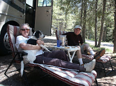
Again, we spent a week here and the time just flew. Just about every day we hiked. Our hikes included Baring Falls, Hidden Lake, Swiftcurrent, Virginia Falls, and Avalanche Lake. We were able to visit most of the park, including the areas along the Going-to-the-Sun road, Two Medicine and Many Glaciers. Prettiest of all was Virginia Falls. The biggest surprise in this park was the number and variety of flowers. As the name would indicate, one would expect to at least walk upon or touch a glacier; no sir! They are rapidly disappearing and remain inaccessible, at least to people like us, who have to view them through a binocular. Another big surprise was the number of people visiting the park. Roosevelt Park had comparatively few visitors and was enjoyable to visit all the areas. At Glacier, there was a traffic jam along the 50 miles of the Sun road. This was partly due to construction along the road, but even where there wasn't any, it was bumper-to-bumper. At Logan Pass there was a 30 minute wait just to get a parking space. If we didn't have handicap permit, we'd still be waiting to park. The Park Service was of no help in alleviating the congestion. So, to see what we did, we really needed the full week.

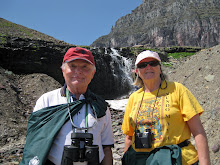
Traveling the Going-to-the-Sun road, at Logan Pass, 6,646 ft, we took a nice vigorous hike to Hidden Lake as shown below.


Below is Jefferson Glacier is shown below as seen from the Sun road. We are told that by 2020 there will be no glaciers left in the park. Not to worry though, for the scenery is absolutely beautiful none-the-less.


Below are some pictures of our 5.2 mile hike to Avalanche Lake, along Avalanche Creek. The trail started along a boardwalk then took us along the creek to the lake where one can see three waterfalls going into the lake. It was a difficult (for us elevations are always difficult) but wonderful hike, the view of the lake and waterfalls being worth the effort.


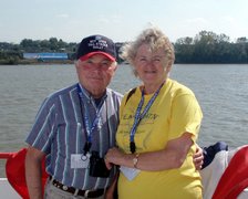
We drove to Two Medicine Lake on the east side via US 2 and took a boat ride and ranger guided hike to Twin Falls. There are two falls here, but I was only able to get in one at a time, so I'm just including the best one, which is of course, the one in which we were in.


On Friday, Aug 7th, while my wonderful wife was in Mountain Meadow campground doing the laundry, I went white water rafting on the Flathead River. It was great fun and I enjoyed it immensely. In the picture below, I'm sitting up front on port side, wearing a PFD which looks too big for me and my Tillie hat.


We took the Sun road to the east entrance and then went north to the Many Glacier area. We hiked around Swiftcurrent lake, saw a hen grouse with several chicks and got my great picture of a brown bear from the car. He was just walking along the side of the road unconcerned about the guy in the Honda taking his picture.


Below are some scenes along the Sun road. I am standing by a red park bus in my new Glacier T-shirt that has a picture of a red bus on it. I also got a great picture of a big horn sheep, again from the car while on the Sun road, who was just inches from us. The mountain goat was by a trail just off the Sun road.


I mentioned the beautiful flowers in the park, here is a sampling.


The most beautiful and spectacular waterfall that we saw was Virginia Falls. The trail is near St. Mary at the eastern entrance and includes St. Mary Falls , seen on the right, as well. It's a three plus mile trail with a 550 feet elevation change. As with Avalanche Lake, the scenery was worth the effort; and we saw two falls close up on one hike.


Benton Chalet is the winner of the National Trust for Historic Preservation Honor Award 2000. Located at the West entrance of the Park, The Great Northern Railway Chalet opened in 1910, the same year as the Park. It was used by the railroad as a destination for passengers visiting Glacier. Using Swiss chalet styling, the Great Northern Railway hoped to lure Swiss/Alps bound vacationers to Glacier via its passenger service. Today, Benton Chalet offers both lodging and fine dining. We ate there twice, savoring rack of lamb, elk and pork.


On Aug 11 we left Mountain Meadow Campground in Hungry Horse, MT and headed for Three Forks, MT where the Lewis and Clark Expedition camped at the Headwaters of the Missouri.

Theadore Roosevelt National Park-Aug 09

We arrived in Medora, ND on the 27th of July, having traveled 2,069 miles. It lies at the entrance of the Theodore Roosevelt National Park. The story of Medora itself is quite interesting. The town was founded by the Marquis de Mores, a French aristocrat, who in 1883 planned to slaughter range cattle and then ship dressed meat east in refrigerated rail cars. He invested heavily in land, slaughter house, ice house and family home, which can be visited today. Unfortunately, his meatpacking scheme collapsed in 1886 and all the buildings associated with it no longer exist. Medora got its name from his wife, Medora von Hoffman, who came from a wealthy Staten Island, NY family and whose mother, also from Staten Island, was a Grymes: Wagner College is situated on Grymes Hill today. The Marquis continued his adventurous lifestyle after he returned to France, being killed by native tribesmen on the Sahara Desert. Medora never remarried and died in France.

Below is a view of our camp site in Medora and a picture of Millie next to the Little Missouri River which runs along the park, campground and through the town of Medora.


Every summer, the town puts on a western musical about the area called Medora Musical. It's held in an open amphitheater just across from our campground.


We spent several days exploring both the North and South parts of the park. They are about 60 miles apart. Roosevelt first came to the badlands in 1883 and was a neighbor of the de Mores. The inhospitable and barren appearance of the land is deceptive and imparts a dramatic beauty; still, I would not want to be here in the Winter, when the population is well below what it is in the summer. The park is home to a variety of animals and plants. We did a lot of hiking and even got to go horse back riding. We got to see prairie dogs, wild horses, elk, bison and lots of wild flowers, even prickly pear cactus.


Our week here went by quickly; we thoroughly enjoyed hiking, driving the scenic roads through the park and the history of Medora.